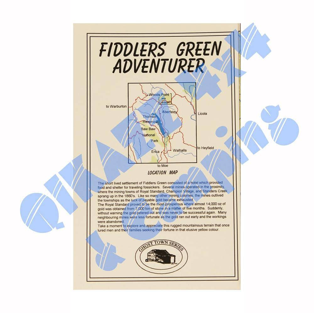
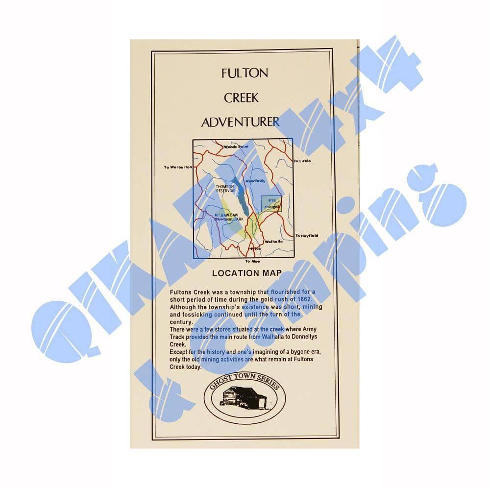
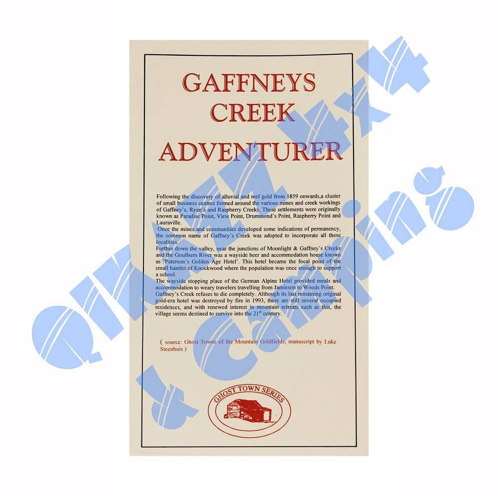
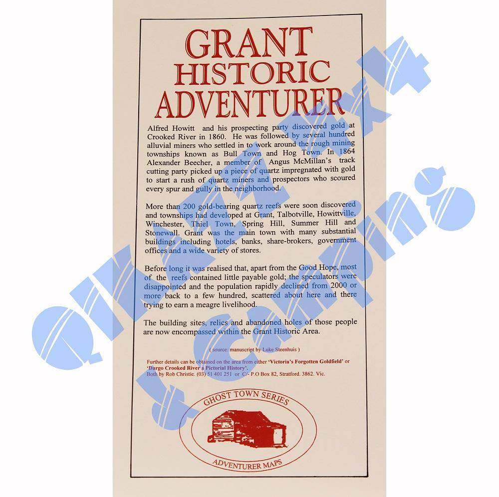
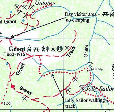
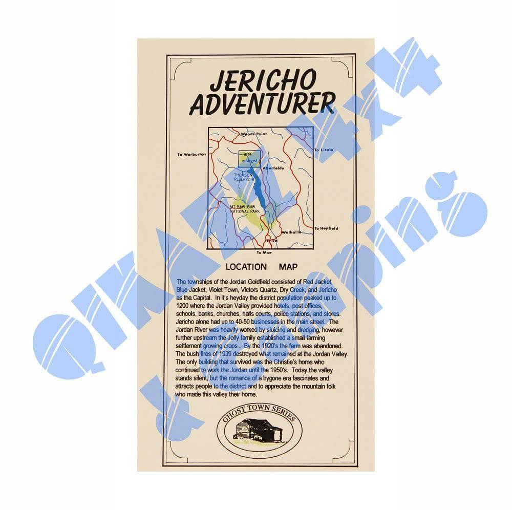
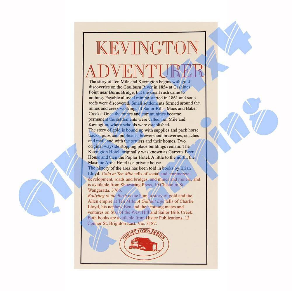
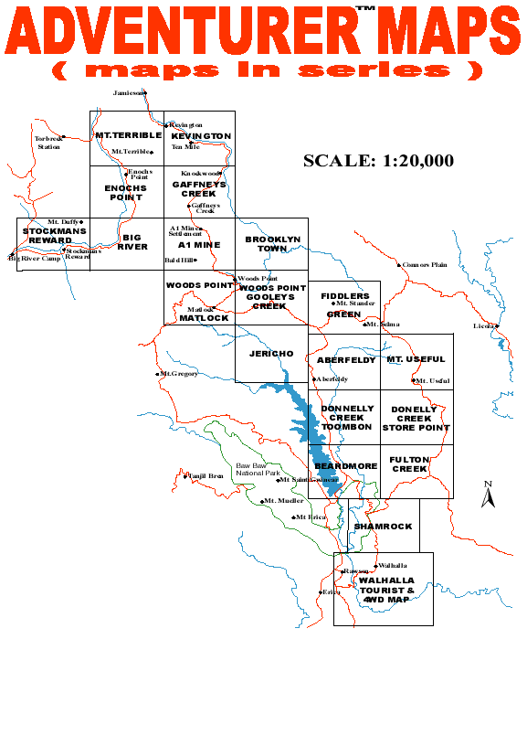
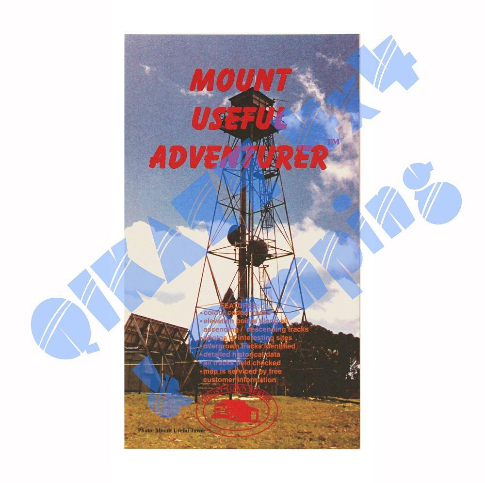
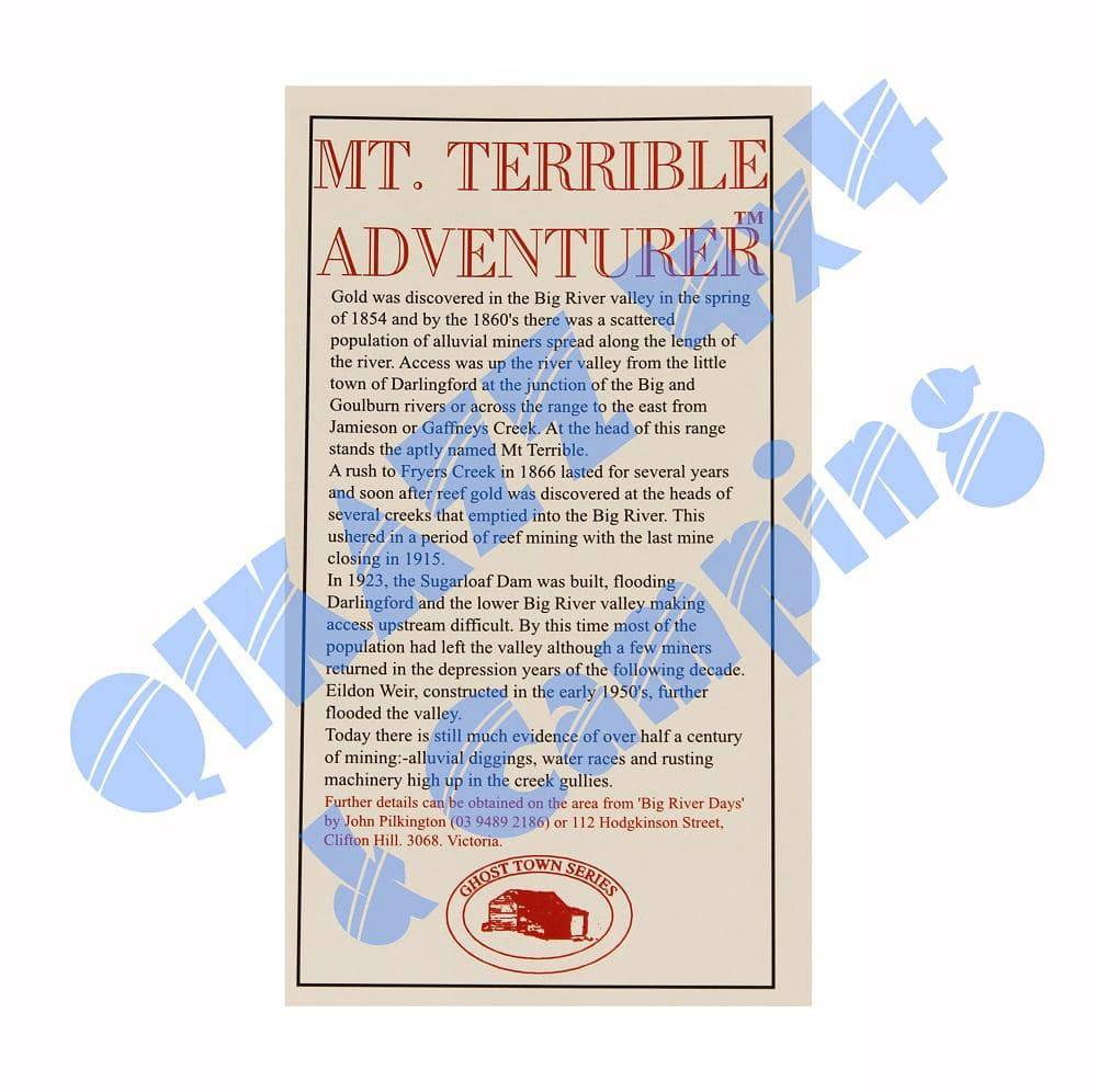
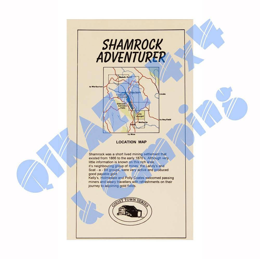
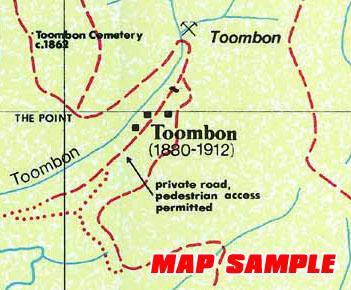
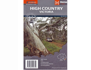
$44.95
$7.95
Tear and Water Resistant
Coverage includes Mallacoota Inlet, Sypsy Point, Gabo Island, Betka Beach, Wallagaraugh River, Port Welshpool, Port Albert, Corner Inlet, Port Franklin, Northern Wilsons Promontory, Yanakie Seal Islands, Snake Island, Sunday Island, Manns Beach, Cliffy Island etc..
Text boxes provide valuable fishing tips and some of the best spots.
Symbols include Boat ramps, beacons, lights, trolling runs, swamps, depths, and a key to likely fish species locations by number.
View full product details$7.95
North Stradbroke Island, Moreton Island, Moreton Bay, Logan River.
View full product detailsSold Out
Camping Guide to Tasmania.
Craig Lewis / Cathy Savage (Boiling Billy)
Experience the very best camping destinations in Tasmania with this full-colour, fully updated and detailed directory to over 200 campsites. It has a comprehensive listing of more than 50 parks, forests and reserves where you can pitch your tent, roll out your swag or unhitch your van. This edition provides concise and accurate details to camping areas throughout the state, including some of Australia's most celebrated bush and mountain areas such as Cradle Mountain-Lake St Clair and Freycinet National Parks.
| Size: | 220mm X 150mm |
| Pages: | 184 pages |
| Binding: | Perfect Bound |
| Publication Date: | 2013 4th edition |
| Images (Colour or Mono) | Full Colour |
| Author and/or publisher | Craig Lewis/Cathy Savage (Boiling Billy) |
$39.95
Hema's best selling atlas
The Australia Road & 4WD Atlas is the ultimate resource for exploring Australia, featuring comprehensive Hema mapping that’s filled with relevant touring information. Pinpointed on the mapping are caravan parks, camping and rest areas, 24-hour fuel, roadhouses, overnight camps and more.
Strong cover, sturdy binding, suitable for all road users.
$59.95
A manual for exploring the outback
Explore Australias arid centre with the Great Desert Tracks Atlas andamp; Guide. Written by some of the most experienced and reputable four-wheel drive enthusiasts in Australia, it is the most comprehensive guide for traversing Australia's desert regions.
Whether you're a 'desert lover', or just looking to tackle some of Australia's favourite 4WD destinations, this informative guide is an indispensable companion to this country's arid centre. The complete atlas contains all six map sheets from Hema Maps' popular Great Desert Tracks maps. This guide features 25 4WD tracks, each with its own detailed inset map showing the route taken, with GPS locations and points of interest featured. All of the tracks are colour-coded to make it simple to find the treks that suit your type of vehicle and handy symbols show towing suitability too. The track descriptions are written by some of Australia's top four-wheel driving enthusiasts and experienced travel writers. Each track's notes contain all the information you need to plan the trip, including permits and contact details. There's also plenty of essential pre-trip reading on how to prepare for your trek, safety in the outback and driving techniques. Background information on geomorphology, major environments and ecosystems, and history makes this the 'must have guide for touring the outrback.
| ISBN: | 9781925195385 |
| Size: | 233mm x 297mm. |
| Pages: | 256 pages. |
| Binding: | Laminated board covers. Spiral bound. |
| Publication Date: | 4th edition. (2015). |
| Images (Colour or Mono) | Full colour. |
| Author and/or publisher | Hema Maps Pty Ltd. |
$14.95
The Great island of sand
A map of Fraser Island (1:130,000) that is the ideal off-road navigation tool to discovering the world's largest sand island. Included are detailed inset maps of Orchid Beach, Cathedral Beach, Happy Valley, Kingfisher Bay, Eurong and Second Valley, Rainbow Beach to Inskip Point and Central Station. On the opposite side is information on everything related to taking on Fraser, including sand driving, dingoes, things to do, permits, island access, Fraser Island Great Walk, water transport options, attractions, when and where to visit, as well as accommodation and information listings.
Features
- Scale 1:130,000
- Edition 9
- Contoured.
- Australian Map Grid.
- Detailed facility symbols.
- Detailed activity symbols.
- Scenic Drives Highlighted.
- Major & minor distances.
- Barge & access information.
- Great Walk Route
- Resort enlargement insets.
- Tourist information & text.
- Excellent colour photography.
- Accommodation listing.
- Tours & transport contacts.
- GPS plotted tracks.
View full product details$14.95
Strong waterproof paper
Coverage extends from Mansfield in the west to the Snowy River National Park in the east and from The Gippsland Lakes in the south to Myrtleford, Bright, Mitta Mitta, Perisher Valley and Tom Groggin in the north, including the Dargo, Licola, Omeo, Bogong and Wonnangatta areas etc.
The map has been printed on durable waterproof, super strong, synthetic paper.
Hema regional maps have a GPS grid, road distances, camping areas, fuel availability, national parks information, long distance hiking trails and lots more.
Scale - 1:200,000
Edition: 7
View full product details$49.95
A terrific touring companion
Latest 3rd Edition.
Part 4WD guide, part travel companion, The High Country Atlas & Guide will help you make the most of your time in Victoria's stunning, mountainous High Country. It provides in-depth coverage of the High Country from Mansfield and Wangaratta in the west to Snowy River National Park in the east, and from the ski fields at Perisher Valley in the north to Lakes Entrance in the south. It offers loads of useful information on the area's rich history, activities and attractions to be enjoyed in all seasons. It also details the 25 most outstanding 4WD excursions the High Country has to offer including inset maps, track descriptions, tips, warnings and more to get you up and running. Along with town and supply centre information you can read about the many sights and activities available in Alpine National Park, Snowy River National Park and Baw Baw National Park. Whether you're looking for a serious four-wheel drive adventure, a winery tour, a walking trail or a place to stay, this book with its easy-to-follow maps throughout is an indispensible companion.
- Handy atlas for navigation - from Hema's best-selling High Country map
- Top 30 4WD Trips, including inset maps, track descriptions and information, warnings and sites worth exploring
- Detailed maps throughout, including southeast New South Wales
- When to go and how to prepare for the alpine conditions of the High Country
- Where to go for the best outdoor experiences - including bushwalking trails and camping spots.
- Where to stay, from B&Bs to the best bush-camping sites
- Extensive listings of tour operators - tag-along tours, renting equipment, guided hiking and horse riding, and much more
- Background reading on the region's geography, history, flora and fauna.
$12.95
Map & Touring Guide
4WD Map covering the forests and coast of the Great Ocean Road & Otway region.
Featuring Great Otway national Park. Otway Forest Park. Otway Drive. Great Ocean Walk.
$12.95
This map provides coverage of Victoria's Mallee National Parks at a scale of 1:350,000. Including roads, tracks, hiking trails, land marks, and points of interest. Suitable for outdoor adventure use such as touring, camping, four wheel driving & wildlife watching.
View full product details$12.95
Wombat State Forest 4WD Touring Guide
Features:
• Scale 1:50,000
• Updated 2008, many new and corrected tracks
• Double-sided with overlapping panel
• Suitable for use with GPS
• Walking tracks & camping areas
• Great Dividing Trail
Sold Out
| Model Number: | AW |
|---|---|
| RRP: | $34.00 |
| Dimensions: | 37.5cm x 30cm x 2cm |
Similar to the map wallet, the atlas wallet is made from heavy duty canvas with a clear PVC front and is designed for everyday maps, atlas' and touring guides.
Just open to the current page and stuff it in! Now you have waterproof protection and easy reading of the map section that you need. It's also great for storing all those travel documents and receipts.
Sold Out
| Model Number: | MW |
|---|---|
| RRP: | $29.00 |
| Dimensions: | 31cm x 29cm |
The map wallet is made from heavy duty canvas with a clear PVC front. It is designed for everyday maps. Open to the current map section you need, fold the map and stuff it in!
Now you have waterproof protection and easy reading of the map section you need. It's also great for storing all those travel documents and receipts. Fits up to standard A4 size paper.
$39.95
Explore Tasmania's back roads and bush tracks
North, South, East or West, no matter where you want to take your 4X4 vehicle, this 192 page guidebook will not only give you concise directions and information on access, campsites and facilities, but also provide fascinating snippets of information about the areas you visit.
Over 60 roads and 4WD tracks are described in this publication together with maps showing all the detail required to navigate to and along the routes.
Each description lists the length of the track, the time required to complete the route, what maps cover the area, the ‘difficulty’ of the trip, general information, historical information about the destinations and warnings to ensure you know what you are letting yourself into.
This book will be kept up-to-date through known changes to tracks being posted on this site from time to time. Just visit this site before you go to make sure you have the latest information.
$10.95
Explore the Murray Valley and North East Victoria
Map coverage is from Rutherglen to Hume Weir and Tallangatta in the north and from Wangaratta to Myrtleford and Eskdale in the south. Beechworth is positioned approximately in the centre. Scale of the main Adventure Map is 1:100,000. The reverse side has a 1:50,000 enlargement titled 'Beechworth Forest Activities Map' giving good detail of Chiltern, Mount Pilot, Beechworth, Yackandandah and the State Forests around Stanley.
All parks, reserves and state forests are shown and more than 7500km of roads and tracks have been plotted using GPS mapping technology.
View full product details$14.95
2nd Edtion 2018
Bright Dartmouth:Includes Omeo, Victoriua Falls, Dinner Plain, Falls Creek, Mount Feathertop, Falls Creek, Harrietville, Bright, Mount Beauty, Dederang, Mitta Mitta, Lake Dartmouth, Glen Valley, Anglers Rest, Benambra etc.
Recommended 4X4 map for Lake Dartmouth, Mayford, Mitta Mitta, Angler's Rest, Glen Wills.
Pictorial inset on the bush huts of the Bogong - Hotham region.
A 1:50,000 scale Forest Activities Map of the Bogong, Bright and Mount Hotham Region fills the entire reverse side.
Printed on waterproof paper.
(Source: A.B.C. Maps & Guide Books distributor marketing).
| Edition | 2nd edition. |
| Publication date | 2018 |
| Map Scale | 1:100,000 with 1:50,000 enlargement. |
Sold Out
The perfect map for exploring Bright's alpine area
Map coverage is from Myrtleford, Bright, Moyhu and Benalla in the north to Mansfield, Mount Buller and Wonnangatta Station in the south. It includes Whitfield, Harrietville, Buckland, Buffalo River, Mount Buffalo, Powers Lookout and part of the Alpine National Park. Scale is 1:100,000.
The reverse of the map has a 1:50,000 scale enlargement titled 'Bright - Whitfield Forest Activities Map' featuring Mount Buffalo National Park which is ideal for bushwalking.
Recommended map for 4X4 to Buckland Valley, Buffalo Valley, Tolmie, Toombullup, Cobbler Lake, King River.
All parks, reserves and state forests are shown and all roads and tracks have been plotted using GPS mapping technology.
| Edition | 3rd edition. |
| Publication date | 2016 |
| Map Scale | 1:100,000. (reverse map 1:50,000) |
$10.95
Forests, National Parks and Estuaries of a portion of far East Gippsland
Coverage extends from Orbost and McKillops Bridge to Cann Valley Highway and Tamboon Inlet.
An inset map on the reverse side covers the coastal access from Cape Conran to Wingan Inlet including Point Hicks, Sydenham Inlet (Bemm River) and Tamboon Inlet. Inland the map includes Delegate, Bonang, Bendoc, Goongerah, Combienbar, Cabbage Tree Creek, Bellbird Creek, Glen Arte, Murrungowar, Errinundra National Park, Club Terrace, Tubbut, Deddick etc.
Inset maps on the reverse side include:Sydenham Inlet Access Map; Tamboon Inlet Access Map; Huts & Waterfalls - Far East Gippsland; Cape Conran Coastal park & Camping Area; Attractions Around Bendoc; Neville Falls - Princes Hwy Map; Suggan Buggan - Willis Map; Coastal Access Map: Cape Conran - Wingan Inlet.
This could well be the best Rooftop Map yet!!
Scale of main map is 1:100,000. Roads and tracks have been carefully field-checked in 2007 / 2008 using GPS technology. Barcode 689076533058.
$5.95
Buxton to Taggerty
Coverage includes all of Cathedral Range State Park between Buxton, Taggerty and the Blue Range Road.
All walking tracks have been field-checked and the map contains notes for a selection of easy and hard walks. There is also a map of Buxton township walking and mount bike tracks.
Pocket-sized map. Waterproof andamp; tear resistant.
View full product details$5.95
Ideal for motor bikes and 4WD vehicles.
Waterproof map covering the Cobaw State Forest, north west of Lancefield. Scale 1:50,000.
| Edition | 2nd Edition. |
| Publication date | 2014 |
| Map Scale | 1:50,000 scale. |
| ISBN | 9.78E+12 |
$12.95
Featuring the magnificent Wonnangatta Valley
Map coverage is from Licola to Mount Hotham and from Briagolong to the Buckland Valley and everything in between including access routes into Wonnangatta Station, the Crooked River goldfields, Upper Dargo goldfields and Mitchell River National Park. As well as detailed road and track information, there are lots of useful tips and warnings noted agains various tracks.
Scale is 1:100,000. First published last revised in 2006. See extract. The reverse side has a 1:50,000 scale enlargement titles Dargo - Howitt Plains Forest Activities Map providing more detail for Wonnangatta valley, Crooked River and the Howitt Plains near Licola.
$8.95
Includes over 130km of coastline
Coverage of the coastline extends from McLoughlins Beach to Lakes Entrance and inland to Heyfield, Boisdale, Newry, Stratford and Bairnsdale. Virtually all waterways and public accessible roads and tracks are shown. The terrain was extensively field-checked by GPS in 2007.
Scale 1:100,000 (with some 1:50,000 enlargements)
Published 2007
View full product details$11.95
Ideal for bushwalking
Coverage includes Thredbo, Charlottes Pass, Perisher Valley, Tom Groggin, Guthega, Geehi, Cabramurra, Kiandra, Selwyn Snowfields, Jagungal Wilderness, Khancoban, Jindabyne etc.
Detail includes roads, tracks, walking tracks, watercourses, bush huts, contours. The entire map was thoroughly field-checked in 2008.
Scale: 1:50,000
Edition: 1
Published: 2008
View full product details$11.95
Ideal for bushwalking
Coverage includes Long Plain, Talbingo, Yarrangobilly Caves, Buddong Falls, Tantangara, Blowering andamp; Talbingo Reservoirs, Cabramurra, Selwyn Snowfields, Currango Homestead andamp; Blue Waterholes.
Detail includes roads, tracks, walking tracks, watercourses, bush huts, contours. The entire map was thoroughly field-checked from 2008 to 2010.
Scale: 1:50,000
Edition: 1
Published: 2011
View full product detailsSold Out
The essential map for Craig's Hut, Mount Stirling and Sheepyard Flat
Map coverage is from Mansfield and Lake Cobbler in the north to Jamieson, Kevington and Mount Sunday in the south. It includes Craig's Hut, Sheepyard Flat, Mount Buller, Mount Stirling, Howqua Hills, Jamieson River, Mansfield State Forest, Alpine National Park (part), King Billy, and Macalister Springs. Scale is 1:100,000.
The reverse of the map has a 1:50,000 scale enlargement titled 'Sheepyard Flat - Craig's Hut Forest Activities Map' with contours.
All parks, reserves and state forests are shown and all roads and tracks have been plotted using GPS mapping technology.
Fifth edition (2013).
$12.95
Explore the Mystic Mountains
Rooftop's first waterproof map
Map coverage is from Mansfield, Bonnie Doon and Merton in the north to Warburton Upper Yarra reservoir and Matlock in the south. It includes Marysville, Lake Mountain, Cathedral Range, Yarra Ranges National Park, Big River, Rubicon, Eildon, Gaffneys Creek, Woods Point and Jamieson. Scale is 1:100,000.
The reverse of the map has enlargements of the Cathedral Range, Marysville Walks, Buxton Mountain bike trails, Marysville rebuild (a fascinating map), and a pictorial guide to what's under Lake Eildon.
All parks, reserves and state forests are shown and all roads and tracks have been plotted using GPS mapping technology.
$4.95
Rapid gradings by Canoeing Victoria
This is a 1:50,000 pocket-sized map of the National Park. The map includes walking tracks, 4WD tracks, roads, picnic and camping areas and details of rapids in the popular canoeing section between Tabberabbera and the Iguana Creek bridge.
New extensions to the National Park are also shown plus access to the old Mitchell Dam, an historic bluestone weir which was destroyed by floods soon after completion.
View full product details$5.95
Ideal for bushwalking
This map is a handy pocket-sized map of access tracks to and from the highest mountain in Australia. It includes walking tracks from Thredbo and Charlottes Pass as well as The Main Range Walking Track.
Scale: 1:25,000
Edition: 1
Published: 2008
| Edition | 2nd edition. |
| Publication date | 2016 |
$7.95
A top bushwalking area
Coverage includes all walking tracks to Mount Feathertop; Harrietville, Upper West Kiewa River, Mount Hotham, Dibbins Hut, and an inset map for walks near Dinner Plain.
Facility symbols include Bush Huts, Toilets, Parking, Camping and Walking Access Only.
The 1:50,000 scale map also includes, roads, vehicle and walking tracks, contours, elevations, GPS co-ordinates and grid references for major points of interest.
2nd Edition
2009
View full product details$4.95
Bright to Mount Buffalo
Coverage includes Bright, Porepunkah, Mount Buffalo Chalet, Eurobin Falls, The Horn, Lake Catani, Rocky Creek Track, Dicksons Falls etc..
Facility symbols include Camping Areas, Caravan Parks and Toilets.
The 1:50,000 scale map also includes, roads, vehicle, walking tracks, contours, elevations, and GPS co-ordinates.
View full product details$10.95
Featuring Mount Disappointment Forest
Coverage includes Reedy Creek, Wandong, Upper Plenty, Mount Disappointment, Hazeldene, Flowerdale, Strath Creek Falls, No.1 Camp, Blair's Hut etc.
Facility symbols include Camping Areas, Picnic Areas, Lookouts and Fishing Spots.
The 1:50,000 scale map also includes, roads, vehicle, motorcycle and walking tracks, contours, elevations, and GPS co-ordinates with an inset of the Strath Creek falls area.
Also Featuring Kinglake National Park
Coverage includes Kinglake West, East & Central; Steels Creek, Strathewen, Pheasant Creek, Masons Falls, Mt Jerusalem, Mount Robertson, West Bridge, Wombelano.
Facility symbols include Camping Areas & Wineries.
The 1:50,000 scale map also includes, roads, vehicle, motorcycle and walking tracks, contours, elevations, and GPS co-ordinates.
New waterproof edition.
View full product details$11.95
Featuring the Snowy Mountains as you have never seen them
Includes: Parts of Alpine and Kosciuszko National parks, Tom Groggin, Adaminaby, Kiandra, Berridale, Dalgety, Lake Eucumbene, Thredbo, Perisher Valley, Cooma and Selwyn Snowfields.
Information includes walking tracks, vehicle tracks, roads, bush huts, watercourses, places of interest, warnings etc.
The reverse side includes enlargements of Mount Kosciuszko summit access and Lake Eucumbene plus a special map of around 40 bush huts in the National Park.
Scale: 1:100,000
Edition: 1
Published: 2008
View full product details$10.95
$11.95
The Toolangi-Black Range Forest Activities Map is at a scale of 1:50,000 and covers the area between Maroondah and Melba Highways.
This map includes:
This map also includes the areas Black Range, Toolangi & Marysville State Forests, part of Goulburn River, Murrindindi Scenic Reserve, Alexandra, Marysville and Yea.
View full product details$12.95
Explore the interesting Toolangi, Macedon & Murrindindi Country
Map coverage is from Alexandra, Narbethong and Buxton in the east to Cobaw, Lancefield, Macedon and Romsey in the west. It includes Cobaw State Forest, Tallarook State Forest, Mount Disappointment State Forest, Toolangi State Forest, Black Range, Kinglake National Park, Healesville, Murrindindi, Yea, Highlands, Seymour and much more. Scale is 1:100,000.
The reverse of the map has a 1:50,000 scale enlargement titled 'Macedon Ranges Forest Activities Map' and also 'Cobaw Ranges Forest Activities Map' and 'Tallarook Forest Activities Map' all with contours.
All parks, reserves and state forests are shown and all roads and tracks have been plotted using GPS mapping technology. Waterproof paper.
$6.95
How to find the magical valley
This map shows all vehicle access tracks into the Wonnangatta Valley. Coverage from the north (Myrtleford and Buckland) begins near the Great Dividing Range, while coverage from the west (Licola) and south-east (Dargo) only shows the final approaches to the valley.
Coverage includes Wonnangatta Station, Herne Spur, lower end of Zeka Spur, Humffray River, Mount Sarah, Tea Tree Range, Rileys Creek, Beveridge's Station, Catherine Station, Mount St Bernard, Blue Rag Range etc.
Facility symbols include Camping Areas, Bush Huts, Toilets and Fishing Spots.
The 1:50,000 scale map also includes, roads, vehicle, motorcycle and walking tracks; contours, elevations, National Horse Trail, Australian Alps Walking Track and GPS co-ordinates.
View full product details